
I had another business trip this month, near Hartford CT. The meetings were long and there was no time to explore or take any "scenic" pictures. However, I snapped a few inside shots from the tour we had today.
The first picture on the right is the board room. If you've seen one, you've seen them all... This was was particularly well equipped with live sports feeds on several flat panel HDTV monitors. The next picture is a set from the studio of a famous sports program....
The last shot was taken from one of the control rooms.
Thursday, March 27, 2008
Bristol, Connecticut
Friday, March 14, 2008
My Photos on Google Earth
Have you used Google Earth lately? If you have installed it and have updated to version 4.2 or later, you can now see my photos located on the map in the locations where they were taken.
Here is link to download Google Earth, (it's free!): http://earth.google.com/download-earth.html
Google Earth uses something called KML files (for Keyhole Markup Language). Google says:
"What HTML is to regular Internet browsers, KML is to geographic browsers. You can open KML files in both Google Earth and Google Maps, as well as in many other geographic browsers.
"What HTML is to regular Internet browsers, KML is to geographic browsers. You can open KML files in both Google Earth and Google Maps, as well as in many other geographic browsers.
I now have KML files that link to my photos directly from Google Earth or Google Maps. Just click on the link under my weather sticker on the right side of this page that says: Open Google Earth KML File. When asked, open it with Google Earth. Wait for the main satellite images to load according to the progress bar at the bottom of the screen. Once they have, you should see some small square photos on the earth. (Most of them will be in Colorado.) Zoom in using the regular Google Earth navigation and you'll be able to see exactly where the photos were taken. If you click on the thumb-nail photo, it will open a larger window with the photo that says "Panoramio" at the top.
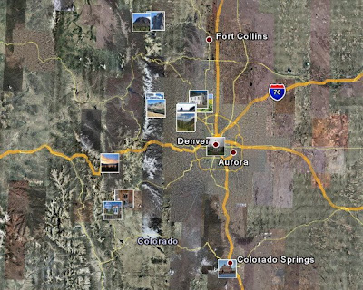
(Thumnails of my photos from the KML files)
If you download the KML file directly from this site, you can see all the photos that I have submitted to Panoramio. Once Panoramio approves the photos, they will show up in everyone's Google Earth view automatically - no need to download. However in that case you'll see EVERYONE's photos, and finding mine may be difficult.
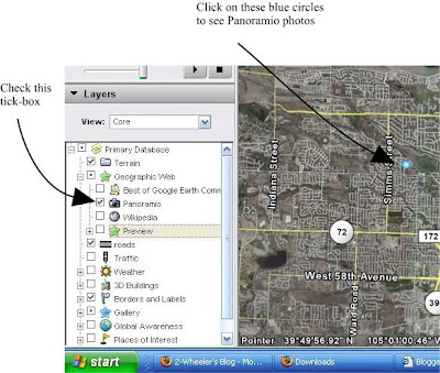
Here is an on-screen snap showing how to activate the Panoramio photo layer inside of Google Earth. Click it on to see everyone's photos, click it off and use the KML download to see just my photos.
Edit April 9th: A simpler way to see my photos on Google Earth is to simply go to the top of the left navigation bar and find My Places, then right-click and select Add > Network Link... Name the link 2-Wheeler's photos or something you'll remember, then add this link as the Link: http://www.panoramio.com/panoramio.kml?user=871434&
Make sure the check-box is ticked and everytime you open Google Earth, it will automatically show any new pictures I've geotagged and placed on Panoramio. That's it, no manual downloading needed.
Thursday, March 06, 2008
A Two-Hour Walk in Washington DC

Here is the rest of the story of my morning walk past the sights of Washington DC. The image shows my GPS track log superimposed on a GoogleEarth satellite view of Washington DC. The light blue lines represent the path of my walk that morning. The distance was 4.6 miles for this route. It does not show the distance to/from my hotel, nor the distance I walked to my meeting.
The image also shows very small thumbnail images pinpointing the location of each photo I took on the walk. (Click the map image for a larger view.)
To explore my walk interactively, you can download the track-log from here, then open it with GoogleEarth to allow you to zoom in and see each sight.
Wednesday, March 05, 2008
Technology of a Mobile Blog
I have been using this blog site to display photos to show some sights of my travels. I've been developing some tools that allow me to upload them more easily from the road. My inspiration has been our friends blog that documented their trip by bicycles across the US. They needed to pack light and were some early adopters of mobile blogging. See their blog here: PaddedShorts
For my trips prior to this year, I have brought a laptop computer to do the work. Some of the tasks that needed a laptop were: photo touch-up, resizing and cropping. The PC also included the WiFi adaptor that allowed me to use a public hotspot from a Starbucks or local library to connect to the Internet for uploading. The PC's keyboard also comes in handy for adding brief notes or descriptions to the photos.
This year, I've been testing tools to allow me to leave the laptop home and travel a bit lighter on the road. Here is a brief explanation of what I am now using:
The Hardware:
- Windows Mobile Phone: T-Mobile Dash
- Little-bitty pocket camera: Canon PowerShot SD1000
- SanDisk Micro-SD memory card, necessary to work in the Phone
- SanDisk Micro to Standard SD card adaptor; allows the same card to work in camera
- Garmin Mobile 10 GPS antenna
As it goes, the standard applications are never quite right, so I have to add some special applications to get everything to work:
- RESCO Photo Viewer (for Windows Mobile) v5.34; this allows me to edit, crop and resize the photos from the mobile phone
- Garmin Mobile XT; This is the GPS navigation software that runs on the smart phone. This allows me to capture GPS track logs so the photos can be "Geotagged" - this allows them to be seen from the maps.
The process is still somewhat complicated, as it involves taking the pictures, then moving the memory card to the phone, where I can edit, crop or resize the pictures. This is followed by the process of locating a wireless hot spot (if not using the GSM data network available on the phone), then finally typing out and sending the blog entry as an email with the photo attached from the phone.
You may ask, doesn't your phone have a built in camera? Can't you already email those photos? Wouldn't that be far easier?
Yes, it does have a built-in camera and yes the phone is already capable of sending those photos by email. But, the quality of the built-in cameras is still far behind even a cheap pocket digital point-and-shoot camera.
This is still a work-in-process and more updates will come as I continue to refine the process. For example, I still need my PC to geotag the photos - can't yet do that from the phone. You can see the map of my photos here:
More sights from DC
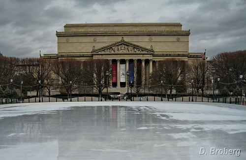
This is the ice rink overlooking the National Archives.
------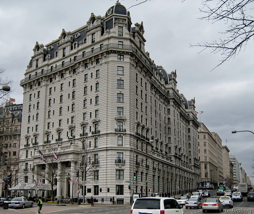
This is some typical architecture of the NW DC area.
------
These early cherry blossoms were only blooming in one place in all the city on March 4th. In front of the Environmental Protection Agency!
-------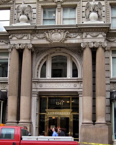
This building entrance on G Street NW, includes the Colorado seal and motto above the door: Nil Sine Numine - "Nothing Without the Deity"
-------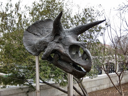
Outside the Museum of Natural History
----------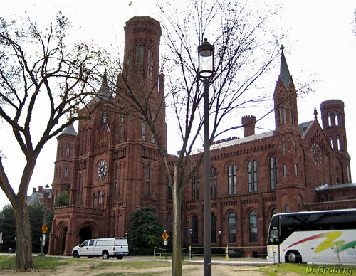
The Smithsonian Institute
---------
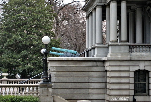
The US Treasury Building
Tuesday, March 04, 2008
Segway-wanna-be
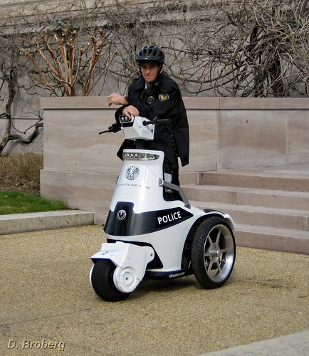
It's not really a segway, but it was kinda cool anyway. It's actually made by a company called T3Motion

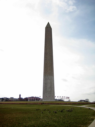
Washington Monument
Here is another photo taken this morning and uploaded from my mobile phone while sitting at a Starbucks.

Sunday, March 02, 2008
Skiing at eldora
Here is a shot of us at Eldora last week.
Below the photo of us, you'll see a snapshot from GoogleEarth showing the GPS track file superimposed on the mountain where we skied. And just below that is a graphical representaiton of the GPS track log with distance as the horizontal scale and elevation as the vertical scale.
To view the track files directly, download it from here and open it with either Google Earth or from Google Maps.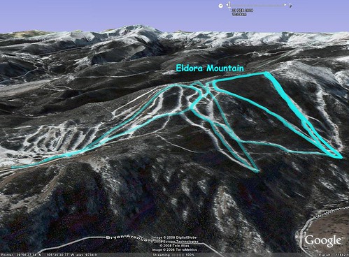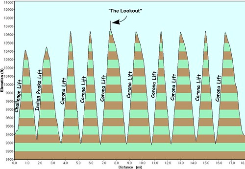
Subscribe to:
Posts (Atom)

